Specifying Geographic Fields
Before creating visuals that use geographic data, we recommend that you specify the appropriate information as Geo Types.
We are using the dataset Canadian Census, constructed from the
files canada_census_population_dwellings.csv and ca-postal-codes.csv, and joined of the fields fsa
and Postal Code, respectively. See Importing Data and Creating Datasets.
The following steps demonstrate how to assign Geo Types to a dataset field. We are using the
two fields from the join of the Canadian Census dataset: fsa from
canada_census_population_dwellings, and Postal Code from
ca_postal_codes.
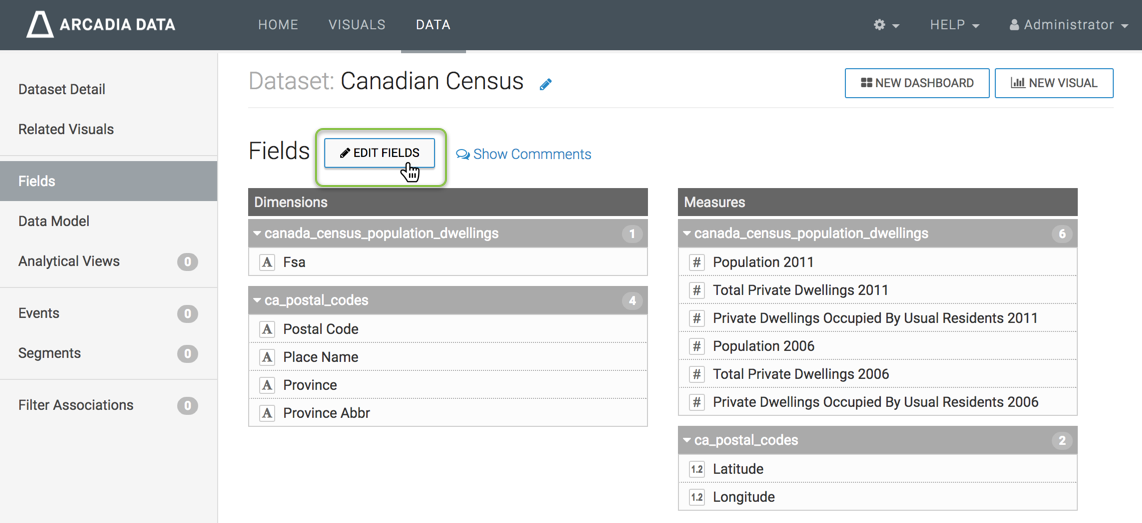
Navigate to the dataset that you must modify. Here, we are using the Canadian Census dataset.
- In the Dataset Detail menu, select Fields.
-
In the Fields interface, select Edit Fields.
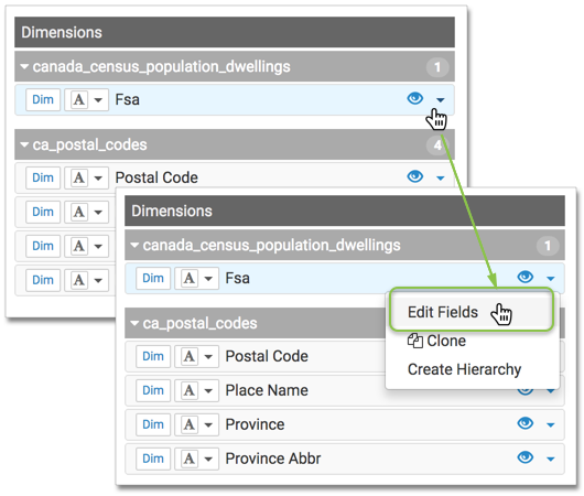
Editing the Fields of Dataset 'Canadian Census' To specify that the field is a Geo Type, In Edit mode, click the (down) icon on the right side of the field, and select the Edit Fields option.
In the Edit Field Parameters window modal, under Geo Type, select the appropriate option from the menu, and click Apply. For
Fsa, we also changed the Display Name toPostal Code.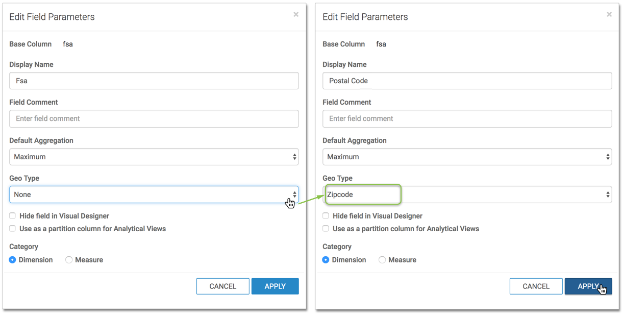
-
Repeat for the
Postal Codefield of the tableca_postal_codes, and click Apply. - Repeat with the
Provincefield of the tableca_postal_codes, changing the Geo Type toState/Province. Click Apply. - [Optional] Apply the Geo type to the fields that represent Latitude and Longitude, if they are not named appropriately.
-
Under Dataset: Canadian Census, click Save.
The dataset can now be successfully used for map and interactive map visuals, without further adjustments at the level of the visual.