Interactive Maps; Layer Options
By default, interactive maps render with a simple heatmap layer and a cluster. However, Arcadia Enterprise has several adjustments to all four main layering options: Heatmap Layer Options, Cluster Layer Options, Circle Marker Layer Options, and Marker Layer Options.
The following steps demonstrate how to make changes to layer specifications in interactive maps.
-
Clone the visual previously built in Interactive Map Visuals.
For a reminder on how to clone visuals, see Cloning Visuals.
In the top visual menu, on the right side, click Settings.

-
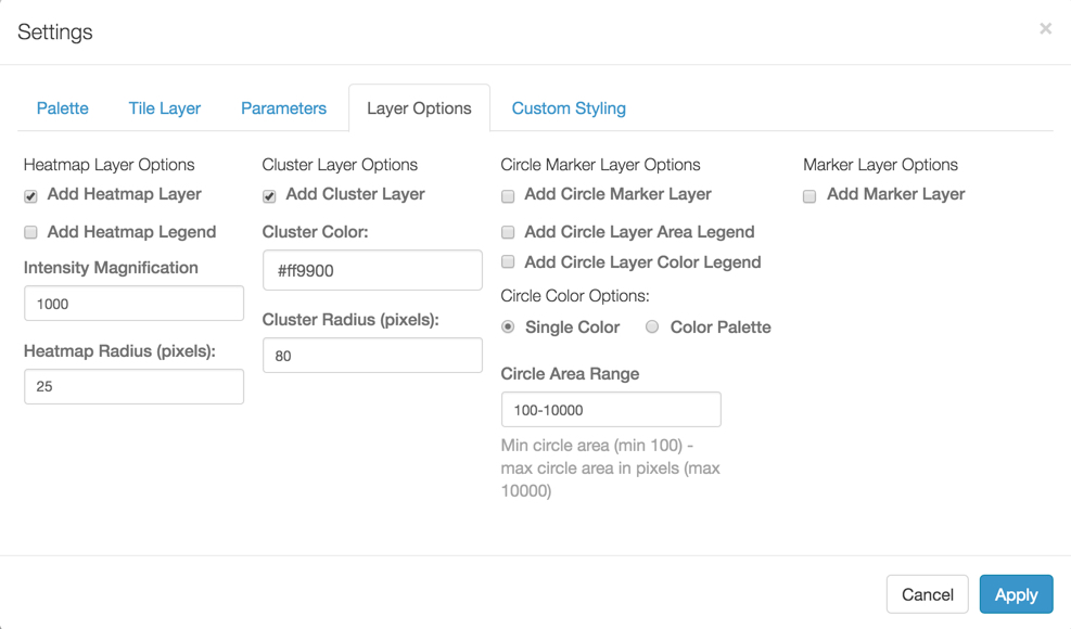
In the Settings interface, select the Layer Options tab, and note that the 4 groups of layer options, described in Layer Options:
-
Note that by default, both the Heatmap and Cluster layers are selected. Make the necessary changes, and then click Apply.
For details of possible changes and their effects, see the individual layer option described in Layer Options.
- Change the title of the visual, and Save it.